


On the hunt for old trails
Can native footpaths be found 170 years after they were mapped?

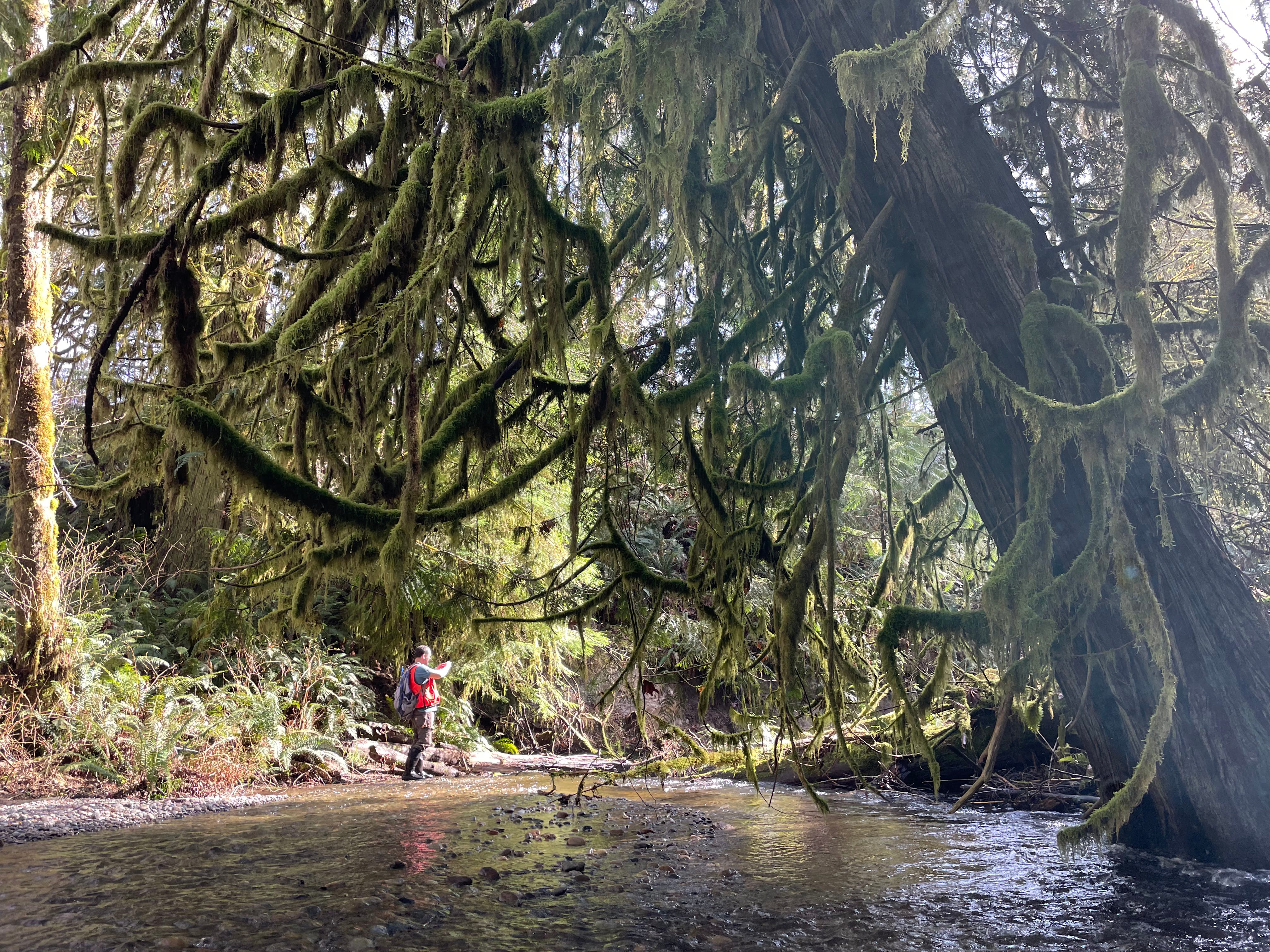
There is a moment when I think we both can sense it, what it would have been like to travel across the peninsula before the advent of concrete and cars. It took a rough scramble through thick brush and downed trees to get here, but we have emerged into easy walking. Rocky Creek fills the open forest with the sound of water. Everything is soft and fresh and bright, a carpet of bleeding heart and scattered fern and salmonberry.
Have our feet found one of the old native footpaths? We can imagine.
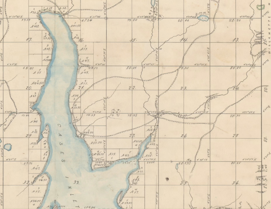
In 2023, Key Peninsula News contributor Joseph Pentheroudakis published his finding that, on an 1850s map created by government surveyors, trails are shown winding through the northern third of the peninsula. Trails built and used by Coast Salish people. To say my imagination flared is an understatement. I pored over those maps. Why did the trails go where they did? What were their landmarks? What special places did they access?
I imagined using the trails to slip through the forest to visit a cousin or go fishing. Striding out the miles through tunnels of green. It would be so different from my usual experience of getting around the peninsula: the KP Highway through a windshield.
One of the footpaths crossed the peninsula from Minter Bay to Rocky Bay. It forked where Rocky Creek’s main branch and east fork have their confluence. A findable place, I realized, especially since today that creek confluence is protected in Great Peninsula Conservancy’s 200-acre Rocky Creek Preserve.
So here I am with fellow forest rambler Nate Daniel, who is GPC’s executive director, to see if any trace of the old trails can be found. (The preserve is not currently open to the public.)
We don’t really expect to find anything. In sagebrush country you might see Oregon Trail wagon ruts of the same vintage as these native trails, but forests here have an appetite. They gobble things up.


Our moment of easy walking does not last. On his phone Nate has the 1850s survey map superimposed on a digital terrain map, plus satellite images. We try to follow the old trail’s general route. It bids us cross Rocky Creek. We have to contort our way through streamside thickets to search for a way across the water, which is thigh-deep in places.
We use a fallen alder as a bridge and are greeted on the far side by devil’s club and red-osier dogwood. Hollows of muck and skunk cabbage. Good for red-legged frogs and water striders; not so good for two-legs. We aim downstream. For a while it is easier to walk in the creek than on the banks. Nate finds a sculpin resting in the sun-dappled shallows. Above us a sharp-shinned hawk spins.
The first creek confluence isn’t where the maps say it should be. Confused, we strike out overland. For the next few hours we alternate between forest walking and creek walking as we find and follow Rocky Creek’s east fork. In one shaded pool we find salmon fry finning.
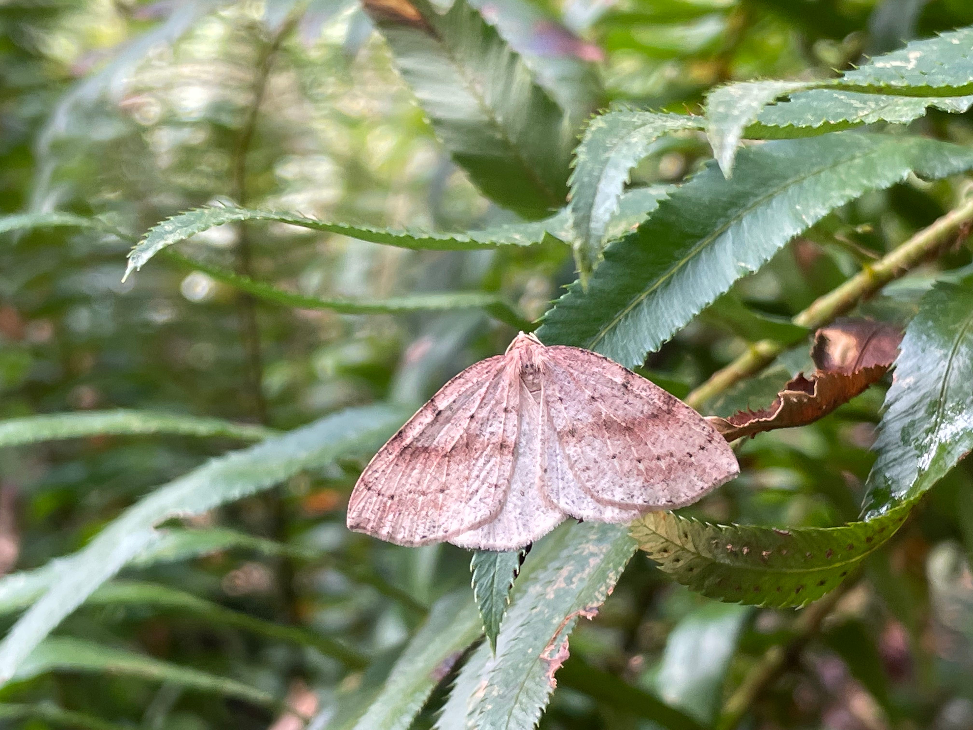
There are times when again our feet find a path of least resistance along a bench of land or a grade in the woods and something clicks and I can imagine it, the old trail. I can feel what a joy it would have been to travel in this way across the peninsula. The sound of the creek. Butterflies attending your steps. The pleasure of passing certain well-known trees. We find a sentinel maple tangled up with a yew. Every bit of me wants to climb them and use them as a lookout.
We came prepared to search for physical clues like bank exposures, linear depressions, odd plant groups, culturally modified trees. But being here in the flesh has me thinking differently. Maybe instinct is a better way to find a long-gone trail. The creek has its gravel bed. How would I flow most naturally across the landscape?
We haven’t quite given up on the phone maps. Near where a thin waterfall sputters down a high landslide-carved bank of sand and clay, we leave the east fork and push up a steep hill. The terrain map suggests another branch of the creek flows beyond it. The 1850s survey says the old trail already departed the east fork and headed north. All we find is thick salmonberry and a sky empty of trees: a big wetland perched atop what we thought was a ridge.
Confused again, we scramble back the way we came. To hell with the maps. Actually the 1850s survey has proven more useful today than the modern digital terrain map.
At the east fork again, I’m drawn to a narrow log that crosses a riffle. Its top is bare and looks almost polished. Could it be a bridge for critters, smoothed by scampering feet? Being in and around the creek all afternoon apparently has me trying to think like an animal.
Nearby, three small blue butterflies—my first echo azures of the year—explore some emerging plants. Then, one by one, I kid you not, they cross the creek by flying just above the polished log bridge.
This trek messes with my sense of what 200 acres is. If a good trail existed, you could cross the preserve in 20 minutes. Being down in the creek and its surrounding complex of high banks and seeps and springs and fins of clay, 200 acres feels as sweeping as a novel. A series of novels. I’m thinking of how, to build a mental map of a place like this, you have to undertake many of these traverses. You have to get off the map and follow your nose. That’s how you learn long stories.
I wish I could walk on those long old footpaths. I wish I could know the peninsula through their rises and falls, their landmark trees, their reunions with creeks.
When it is time to climb out of the creek bottom, we emerge onto the shoulder of Highway 302. Trash crackles under last fall’s maple leaves. We wait for a gap in the traffic and hop the guard rail and grit our teeth and try to make the march on the road’s shoulder as quickly as possible. It is nothing like the creek. We ignore our surroundings and just try to get to where we’re going.
Endnotes
Joseph Pentheroudakis’ 2023 article describes the early survey maps and the native footpath network that existed in the 1850s.
Back in 2021, in the Key Peninsula News, I wrote about exploring an upland forest portion of Rocky Creek Preserve.
This 2018 article (scroll down to Pg. 4) tells the story of the 9,000 year-old Yakima-Cowlitz trail that crosses the Cascades just south of Mt. Tahoma.
Thanks for reading Infinite Peninsula. Subscribe to receive every ramble and adventure, become a paid subscriber to keep me deep in the woods, and share with anyone who would dig a spy’s-eye view of the world we share with Cascadia critters, past and present.
I really enjoy reading your stories and learning about my adopted home. Thanks, Chris.
Chris, Wonderful story of following the land and history and your instincts. I also love those GLO maps and the notes that go with them. Thanks for sharing your story. David